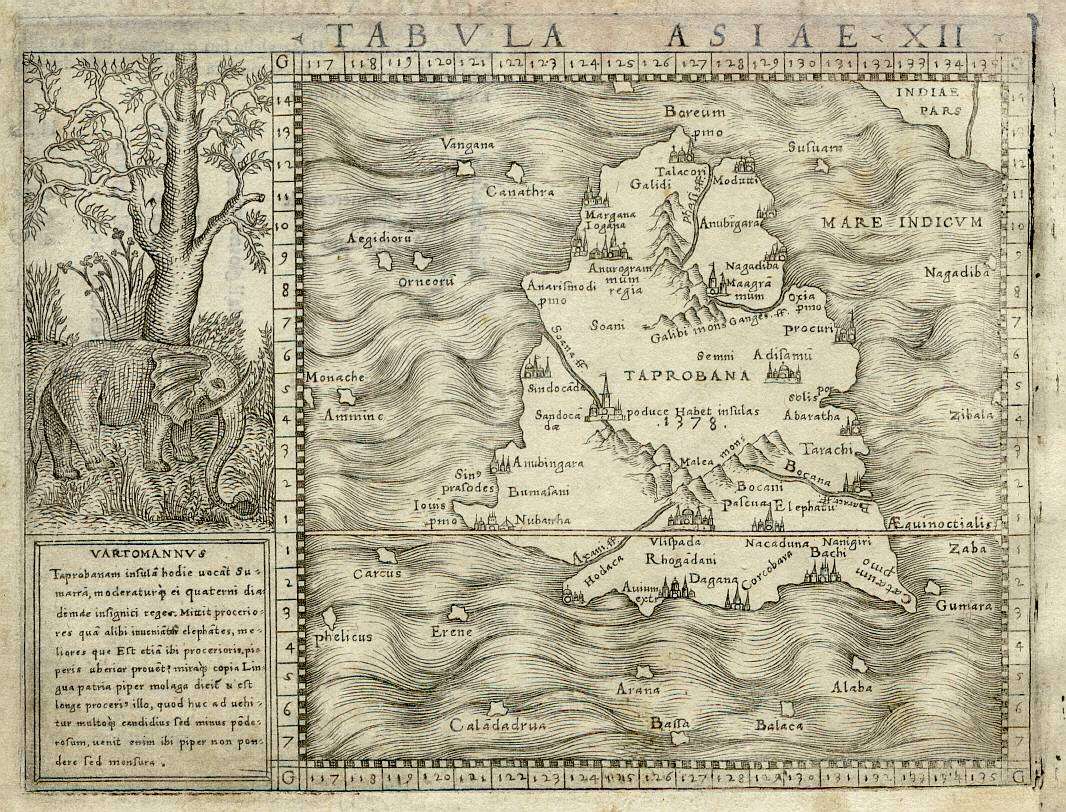
Taprobana and Taprobane was the name by which the Indian Ocean island of Sri Lanka was known to the ancient Greeks.
Reports of the island’s existence were known before the time of Alexander the Great as inferred from Pliny. The name was first reported to Europeans by the Greek geographer Megasthenes around 290 BC. Herodotus (444 BC) does not mention the island. The first Geography in which it appears is that of Eratosthenes (276 to 196 BC) and was later adopted by Claudius Ptolemy (139 AD) in his geographical treatise to identify a relatively large island south of continental Asia. Writing during the era of Augustus, the Greek geographer Strabo makes reference to the island, noting that “Taprobane sends great amounts of ivory, tortoise-shell and other merchandise to the markets of India.” Eratosthenes’ map of the (for the Greeks) known world, c. 194 BC also shows the island south of India called Taprobane.
Taprobana is related to present-day Sri Lanka when referring to the map. But actually is a Reference to LANKA, or the Indians’ True Atlantis/Lemuria.
The reference for Taprobane/Atlantis being in the Atlantic Ocean/Equator of course is false because there are no known Islands of such in the Atlantic.
The map indicates names such as ‘Rhogandani’ in the south (known as Rohana in the ancient times) and Anuragrami in the northwest referring to Anuradha Grama as it was known in the ancient times. Ettukai. Institute of Asian Studies G.U.Pope, in his book “Textbook of Indian History”, claims the name to be derived from Dipu-Ravana, meaning the island of Ravana.


